Metalliferous minerals
Type of resources
Topics
Keywords
Contact for the resource
Provided by
Years
Formats
Representation types
Update frequencies
Scale
-
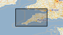
Detailed mining information for mining in Devon and Cornwall gathered by George Dines (former BGS Geologist) for a period around 1921. Maps, plans and accompanying notes and documents provide detailed information on the metal mining ( mainly tin,copper,lead) at that time. A synthesis of this information was published in "The metalliferous mining region of south-west England" 3rd impression 1988.
-
An important paper archive of a wide variety of miscellaneous geological information organised on the basis of its location within 1:50 000 scale geological map sheet areas in Great Britain. The majority of the data has been produced or collected by BGS staff since 1835 as part of the mapping programme. The data may not fit into any of the main collections, but is valuable for future projects and answering enquiries.
-
The dataset comprises plans of various types relating to mining activity, including abandonment plans, gathered since the 1800s. Most were collected as part of the BGS mapping programme and the type and amount of data available will vary considerably. The coverage for Northern England and Scotland is more comprehensive than for the rest of the country. The plans include working copies, compilations and interpretations which may be copyright or confidential. The general nature of some of the plans means that they may not be applicable to a specific site. Current holdings over 60,000.
-
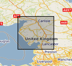
The collection comprises photographic half plate black & white negative and 35mm colour transparency copies of plans of mine workings for haematite, gypsum, limestone, baryte and metalliferous minerals for Cumbria dating from 1872 onwards. The plans were originally deposited in compliance with the Coal and Metalliferous Mines Regulation acts. The original plans are currently held by Cumbria County Record Office on behalf of the Health & Safety Executive (HSE) and total about 1240 plans. No digital index is available but a paper catalogue is provided by the Health & Safety Executive. As the collection relates to plans of mines abandoned after the 1872 Act, the holdings are fairly complete after this date. Note however, that the Metalliferous Mines Act originally applied only to mines employing more than 12 men, (eg. some limestone mines). Coal Authority may hold non-coal mine plans not covered by Mine Abandonment Plan collection.
-
Index to the BGS collection of large scale or large format plans of all types including those relating to mining activity, including abandonment plans and site investigations. The Plans Database Index was set up c.1983 as a digital index to the collections of Land Survey Plans and Plans of Abandoned Mines. There are entries for all registered plans but not all the index fields are complete, as this depends on the nature of the original plan. The index covers the whole of Great Britain.
-
The collection comprises plans of mine workings for ironstone, fireclay, limestone, baryte and metalliferous minerals for Scotland dating from 1872 onwards deposited on abandonment of a mine in compliance with the coal and metalliferous mines regulation acts. The plans are held on behalf of the Health & Safety Executive (HSE) and total about 610 plans. Indexed in the BGS Plans Database Index. As the collection relates to plans of mines abandoned after the 1872 Act, the holdings are fairly complete after this date. The Metalliferous Mines Act originally applied only to mines employing more than 12 men, (eg. some limestone mines). Where non-coal minerals were worked with coal, the abandonment plans are retained by the Coal Authority. Coal Authority also holds exclusively non-coal mine plans not covered by Mine Abandonment Plan collection. All non-confidential data held by NGRC Edinburgh (National Geological Records Centre). Mainly coalfield areas of Central Scotland with large collection relating to the Leadhills-Wanlockhead mining district.
 NERC Data Catalogue Service